Hands-on with Google Maps AR

Does the addition of the real world to Google Maps make it easier for an easily lost journalist to find his way?
The launch of the Google Pixel 3a at Google I/O 2019 was one that had relatively few surprises in store. Most of the key specifications for the Google Pixel 3a and Google Pixel 3a XL had leaked well in advance, giving keen Google watchers little to get really excited about.
Well, except for the one new feature that Google's keeping for Pixel owners only for the moment – Google Maps AR.
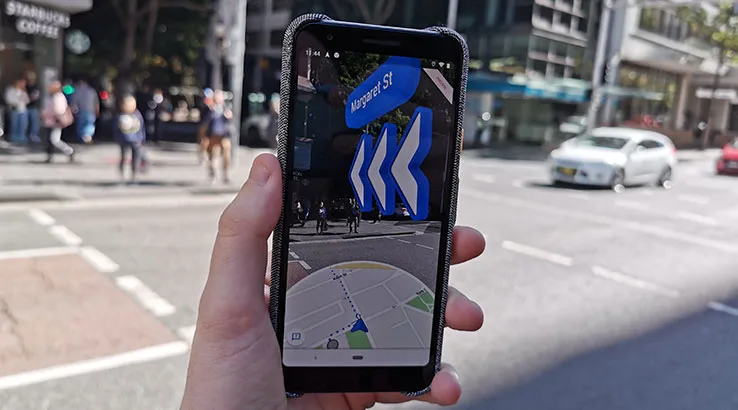
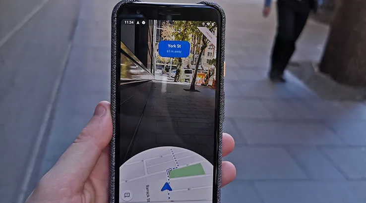
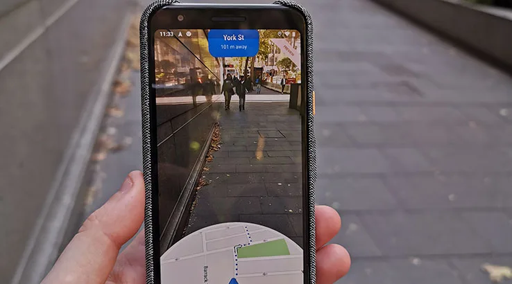
This gives you the familiar Google Maps experience for finding your way around, with the option of an augmented-reality overlay that makes it easier – in theory – to find your way around unfamiliar environments.
That did get me excited, if only because I have a long history of using Google Maps to get hopelessly lost.
Sometimes that's a compass fault, so I'll walk a block or two in the wrong direction, and sometimes it's just my brain scrambling matters. Less kind members of my family have informed me that I can get lost in a paper bag with holes cut in both ends. You get the picture.
In short, anything that can make getting around an unfamiliar environment easier can only be a good thing, right?
Our review sample of the Google Pixel 3a landed in the Finder offices yesterday, and today I figured I'd give the Maps AR experience a spin.
It's worth noting that AR Maps are still in beta – a familiar position for many Google services – and there may well be significant improvements down the track.
I used the Google Maps AR to navigate to a meeting I had at Barangaroo in the Sydney CBD, not actually all that far from Finder's Sydney offices. In reality, I didn't need the AR Maps experience because I did know where I was going. Still, with a product in beta, I figured it was best to start small.
This isn't a full review – that's a little unfair for a product in early development, and one that's limited for now to Pixel devices only – but just observations on what it gets right, and where there's room for Google to tweak and improve.

Google Maps AR: The Good stuff
- Simple UI. AR can be complex stuff, but setting up your walking trip with AR is easy enough, and you've always got a view of the underlying map at all times.
- Big clear idiot-proof signs. I do know my left from my right, but I've been known to get directions wrong. Having an AR marker floating in space to guide you around makes a big difference to choosing the right way to go – or the left.
- Encourages you to look at the real world: Trying to navigate with standard Google Maps on foot often involves staring at your phone a lot, which is often an issue for pedestrians around you. The app itself gives you that view on the world at all times, as well as encouraging you to put the phone down once you've got your basic bearings.
- Area identification is cool. Google Maps picks your location not only from your GPS, but also by getting you to scan the area around you for familiar landmark buildings and signs. It's literally matching Street View data with what you're showing it, which is very neat technology indeed.

Google Maps AR: The not-so-good stuff
- Still very obvious that you're using Google Maps. If you're concerned about personal safety in an unknown city, then having a phone with big obvious direction arrows on the screen is going to be just as much of a giveaway as using Google Maps itself.
- Put the phone down? You'll have to re-scan. Obeying the Maps instruction to put the phone down is smart, but it means if you do want to do some on-the-spot AR checking, you'll have to re-scan your environment to get it working again. That's a little time-consuming and awkward.
- The undeniable creepy factor. The technology that can quickly match a Street View photo with what I'm looking at is very cool, but it's yet another reminder that Google knows just about EVERYTHING about the areas we all walk around in, day by day. It's rather hard not to think about this every time it identifies where you are just because you're pointing your phone at buildings and signs.
- Doesn't work so well if it can't see buildings. At one point on my trip I walked through Wynyard Park, and put the phone down. As a result, I had to re-scan, but unfortunately trees don't count as recognisable objects to Google Maps. That's understandable in the sense that many trees do look similar, but it highlights that not every area, even those with Street View enabled, will automatically work with Google Maps AR
- Doesn't work for anything but walking. For years, I've wanted a full AR-based mapping solution for in-car GPS. Having it on my phone would be ideal, but Google Maps AR is, for now, a walking product only.
- Limited to Pixel phones. Look, I don't expect this limitation to last all that long. There's no real practical reason that a phone capable of running Maps with at least a halfway decent camera couldn't manage the AR strain present here.
Google Maps AR: The early verdict
For a beta product, built on one of Google's most popular products, Google Maps AR has a lot of promise. While I used it to walk along paths I was already very familiar with, I could totally see myself using it on international travels if I wasn't too sure about locations, or in areas where street signs might be in languages I wasn't familiar with.
Google Maps AR is currently limited to Google Pixel devices, such as the Google Pixel 3a or Google Pixel 3. You can check out the current contract deals on the Google Pixel 3 below: